Conflict and Natural Resources Mapping Report

Natural resources conflicts between sedentary farmers and herders have protracted across several communities in Adamawa and Taraba States, contributing to the escalation of insecurities that impact human and community safety, food security, economic losses and access to livelihoods, social relationships, internal displacement, and conflict-induced/forced migration.
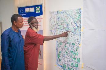
The conflict and natural resource mapping conducted by Mercy Corps' program team revealed the enormity of the socio-economic, political and environmental effects of resource-based conflicts, including the extent of their impacts on relationships and critical community infrastructures such as markets, schools, water sources, health services, and community halls. This mapping, which covered the 12 new communities of the COMITAS II project in Adamawa and Taraba States, showed a scarcity of land and water resources to support the livelihoods of farmer and herder communities.
The mapping revealed that resource-based conflicts are:
- complex
- decentralized
- transcend geo-political and transnational borders
- increase (and create) ethnic and tribal tensions
- facilitate opportunities for criminality, rural banditry, and social policing of groups
This mapping, which is utilization-focused, employed ethnographic methods, including qualitative and descriptive approaches, of data collection and analysis to present the mapping findings. The study recommends that strengthening the negotiation capacities of community conflict resolution structures and supporting them to design and implement resource-based action plans are central to transforming conflict relationships and reducing conflict intensity between farmers and herders.