How participatory natural resource mapping can help communities avoid conflicts

Of the many issues fueling the ongoing different variant of conflicts happening in northeast Nigeria, on top of the list is disputes over shared natural resources such as land and water. Building on the concept of social cohesion, the COMITAS program is supporting communities in Adamawa state to recognize their shared values in resolving conflict drivers associated with shared natural resources. This approach builds on the premise that in understanding that these resources are jointly owned and used, communities will acknowledge their social and material needs and engage in collaborative decision-making and action to resolve issues.
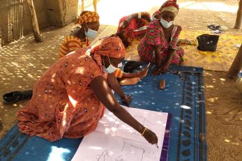
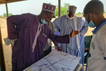
The implementation of participatory natural resource mapping deepened the recognition of the primary sources and secondary drivers of shared natural resource (land and water) conflicts between farmer and herder communities across the 10 COMITAS program areas in Adamawa State. The participatory process serves as an effective measure for supporting communities to reflect on how natural resource conflicts impact their socio-economic and community life and identify the local measures they can adapt to promote peacebuilding.
Communities and the COMITAS program team identified a broad set of land and water resources located across different communities and assessed their interconnectedness to farmer-herder conflicts. The exercise provided awareness about complex relational patterns between farmer and herder communities and highlighted the importance of providing concrete solutions to address the resource-based issues and repair the social relationship of both groups.
Learning from action

- Supporting communities to recognize collective vulnerabilities: Reflecting how long shared natural resource conflicts have lingered between farmer and herder communities, natural resource mapping empowered the program communities to recognize the influences of land and water conflicts on community vulnerabilities and critical livelihoods linked to these resources. Through a collective identification of intercommunal challenges on natural resource use, community representatives, in consultation with their respective communities, could identify, initiate and implement concrete actions that will improve farmer-herder relationships, reduce direct violence, and facilitate the conservation of shared natural resources.
- Capacity gaps in natural resource management and conflict resolution: The existence of limited community awareness about climate change and the effects of human activities on natural resource scarcity and environmental deterioration also worsens direct clashes between farmer and herder communities. This problem is further complicated by the absence of specific community mechanisms outside customary structures to address shared natural resource conflicts. These combining challenges fuel misconceptions and increase unwarranted skepticism about the capability of local actions to reduce resource-based violence, build community resilience, and transform communal fragility. By engaging in natural resource mapping, community members acknowledged the importance of developing strategic and well-defined locally-led mechanisms for negotiating, resolving and operationalizing concrete solutions to shared natural resource conflicts. These mechanisms will provide the needed insights into the scope and scale of impacts on natural resource conflicts and consolidate the efforts of traditional conflict resolution mechanisms to accomplish improved farmer-herder relationships and social change.
- Poor inclusion in initiatives implemented across horizontal relationships: Although traditional dispute resolution mechanisms develop actions to address issues related to land and water conflicts, specific groups, such as women, youths, persons living with disability (PLWDs) and other traumatized people and interest groups, are poorly represented in these initiatives. While many of the traditional conflict resolution models are dominated by ‘elderly males’, the mapping exercise displayed the significance of inclusivity and ‘leaving no one behind’ because of the impact of the conflicts on various groups. Through this realization, communities recognized the importance of operationalizing inclusive and robust engagements to address the experiences and needs of the diverse farmer and herder groups.
Recommendations for COMITAS and Practice
- Sustain intercommunal conflict analysis: As part of interest-based negotiation (IBN) capacity building training that Mercy Corps will conduct for the Natural Resource Management Committees (NRMCs), participants will be exposed to essential conflict analysis tools and methodologies. This component should enlighten committee members on the appropriateness of this action (i.e., conflict analysis) on improving community knowledge about threats, trends and trajectories of shared natural resource conflicts and social cohesion.
- The quality of information developed through sustained conflict analysis will enhance intercommunal awareness about early warning signs of shared natural resource conflicts in order to facilitate proactive response. These community conflict assessments will complement Mercy Corps’ conflict incidence tracker results in communities to guide programming and improve the quality of outcomes delivered by NRMCs in negotiating and resolving shared natural resource conflicts.
- Amplifying gender sensitivity and intersectionality: As NRMCs will develop and implement action plans and convene periodic dialogues and local initiatives, Mercy Corps will use these platforms, and other informational materials, to stress the significance of engaging diverse community voice agencies in problem solving. Although the NRMCs is composed of stakeholders from various local government and community-based institutions, the design and implementation of intercommunal initiatives will demonstrate tangible considerations for the combined needs of community groups—women, men, youths, PLWDs, government, and other survivors of shared natural resource conflicts.
- Capacity building on environmental sustainability: Central to the functionality of natural resource mapping is the usefulness of the activity on community awareness of diverse environmental factors that influence shared natural resource conflicts. Hence, besides awareness-raising activities in communities, NRMCs require capacity building to develop and sustain nature-based solutions towards environmental sustainability and the mitigation of climate change. These capacities will include community conservation mobilization, blue and green corridor initiatives, and understanding weather information and communication networks. Some of the knowledge and skills developed will inform concrete solution projects that will improve social cohesion between farmer and herder communities.
About COMITAS
Contributing to the mitigation of conflict over natural resources between farmer and herder communities in Adamawa State, Nigeria (COMITAS) also aims to enhance collaboration in managing the use of natural resources. This integrated program is funded by the European Union and is currently being implemented by the International Organization for Migration (IOM), Search for Common Ground, and Mercy Corps.